July 3, 2026 – A fire broke out on the island of Čiovo on June 30th, prompting our team at Oikon to carry out a rapid satellite-based assessment of the damage. Using Sentinel-2 satellite imagery and vegetation indices (NBR/dNBR), we estimated that approximately 100 hectares of forest vegetation were affected by the fire.
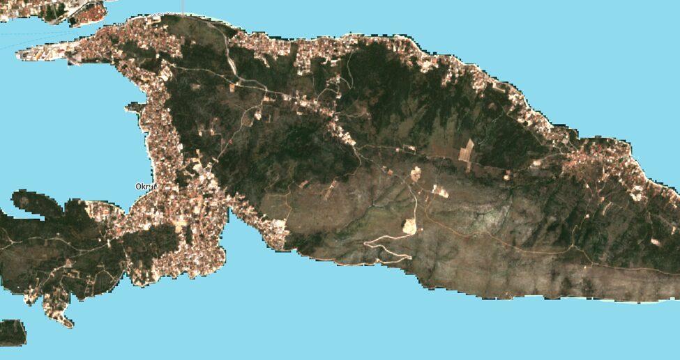
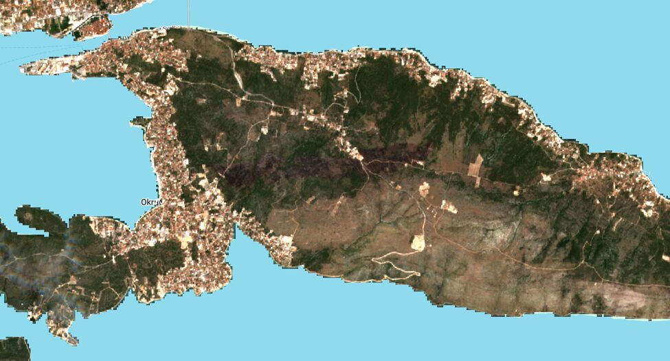
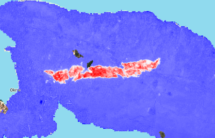
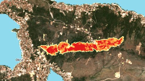
The satellite images above illustrate the extent of the change, comparing the island’s vegetation cover before and after the fire. The accompanying burn severity maps translate this into a classified GIS layer, with different colours representing varying degrees of fire impact on the vegetation – from lightly affected to severely burned areas.
This kind of analysis demonstrates the value of satellite monitoring in emergency response situations. By combining freely available Earth observation data with vegetation indices, we were able to deliver a fast and reliable estimate of the burned area and its severity within a short timeframe of the event – well before ground surveys could be completed.
Rapid assessments like this one support both immediate response efforts and longer-term planning. Accurate, timely data on burned area extent and severity can help prioritise terrain rehabilitation efforts and inform future strategies for wildfire prevention and environmental protection along the Croatian coast.