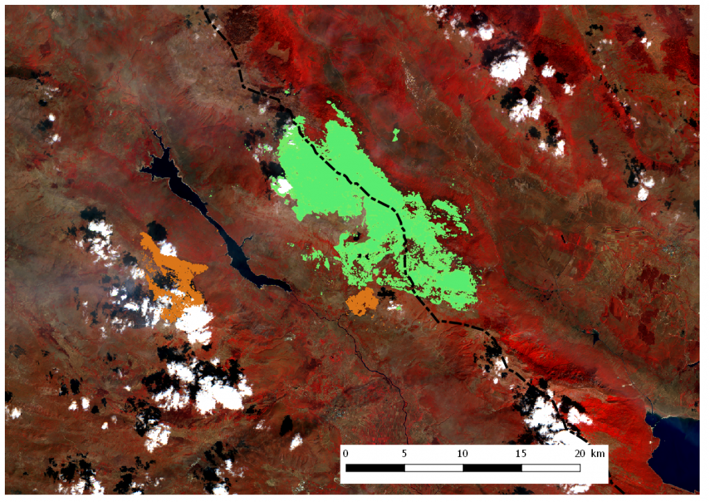
19 August 2017 − We recently published maps of burnt areas on Svilaja Mountain and near Hrvace where we showed the accuracy of semi-automatic classification (light brown – 1032 ha). Our researcher Alen Berta has made a comparison of these surfaces and the fire on Dinara Mountain (light green) that started at about the same time when the Split fire was extinguished (July 22, 2017), while the one on Dinara Mountain was extinguished only a few days ago (August 12, 2017). The analysis was made on the Sentinel 2 satellite image from August 16, 2017 and 9300 ha (93 km2) of vegetation covered area burned down, while half of the burnt areas are on the territory of Bosnia and Herzegovina (dotted black line indicates the state border).
Comparing only the burnt part of the Republic of Croatia (4650 ha, i.e. 46.5 km2) with the data from the graph taken from the State Administration for Protection and Rescue’s report for the Government session in July (https://tinyurl.com/y7raulyf), it represents half of the annual average of the burnt area in karst and coastal areas of the Republic of Croatia. We also see that in the first half of 2017 this average was exceeded by more than three times, and the annual average of burnt areas was only met through this and previously analyzed fires in our previous posts (Split, Svilaja, Hrvace).
It’s been a long, hot summer.