Plan for the use of renewable energy resources in Dubrovnik – Neretva County
Dubrovnik – Neretva County

Dubrovnik – Neretva County


Ministry of Agriculture and Rural Development of Montenegro
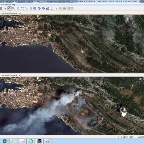
19th July 2017 – One of the possibilities of using a multispectral satellite Sentinel 2 is mapping of burnt areas caused by wildfires. Because of the large wildfire threatening Split in the past few days, our expert Alen Berta has made several maps and an analysis of the burnt area: On the upper parts of the enclosed … Continued

Croatian Forest Advisory Agency (Forest Extension Services), Hrvatske šume (legatee of Croatian Forest Advisory Agen

Nature parks: Biokovo, Lonjsko polje (including Krapje Đol), Medvednica, Učka and Žumberak-Samoborsko gorje
